
San Mateo County ZIP Coverage
San Mateo County has a wide postal footprint, from Brisbane and Daly City at the north end to the rural roads of Pescadero Creek and the Coastside. The postal name in a ZIP record is a delivery label. It is not a finding that a parcel lies inside the named city. The rows below preserve the county-level working coverage and flag the places where a ZIP needs a second check in USPS and GIS.
| ZIP | Principal area or postal name | Post office and geography notes |
|---|---|---|
| 94002 | Belmont | Belmont and nearby edge areas; verify the exact address in USPS and GIS. |
| 94005 | Brisbane | Brisbane; county-line and industrial bayfront context. |
| 94010 | Burlingame/Hillsborough | Shared postal geography across two municipalities. |
| 94011 | Burlingame | PO-box postal ZIP. |
| 94014 | Daly City/Colma edge | Crosses local jurisdiction patterns. |
| 94015 | Daly City | Westlake and coastal Daly City areas. |
| 94018 | El Granada | Unincorporated Coastside. |
| 94019 | Half Moon Bay | City plus surrounding Coastside delivery area. |
| 94020 | La Honda | Rural unincorporated southwest county. |
| 94021 | Loma Mar | Rural Pescadero Creek area. |
| 94025 | Menlo Park | City and nearby unincorporated pockets. |
| 94027 | Atherton | Atherton. |
| 94028 | Portola Valley | Town and adjacent rural area. |
| 94030 | Millbrae | Millbrae. |
| 94037 | Montara | Unincorporated Coastside. |
| 94038 | Moss Beach | Unincorporated Coastside. |
| 94044 | Pacifica | Pacifica. |
| 94060 | Pescadero | Broad rural Coastside delivery area. |
| 94061 | Redwood City | West and south Redwood City, with nearby areas. |
| 94062 | Redwood City | West Redwood City, Emerald Lake Hills, and Woodside-edge delivery geography. |
| 94063 | Redwood City | Downtown and east Redwood City; County Center. |
| 94064 | Redwood City | PO-box ZIP. |
| 94065 | Redwood City | Redwood Shores postal area. |
| 94066 | San Bruno | San Bruno. |
| 94070 | San Carlos | San Carlos. |
| 94074 | San Gregorio | Rural coast. |
| 94080 | South San Francisco | City and industrial areas. |
| 94083 | South San Francisco | PO-box ZIP. |
| 94096 | San Bruno | PO-box or unique postal uses; verify current USPS status. |
| 94098 | San Bruno | PO-box or unique postal uses; verify current USPS status. |
| 94401 | San Mateo | Downtown and northeast. |
| 94402 | San Mateo | West and central areas, with Hillsborough-edge postal geography. |
| 94403 | San Mateo | South and east; Hillsdale and shore areas. |
| 94404 | Foster City/San Mateo | Primarily Foster City; “San Mateo” mailing use creates a city mismatch. |
| 94497 | San Mateo | Unique or organizational postal use; verify current USPS assignment. |
This is a county coverage list, not a municipal-only roster. A PO-box or unique ZIP can identify a delivery function without identifying a residential parcel. A rural ZIP can cover a large area with few civic clues. Use the table to choose a starting code, then confirm the individual address before treating any record as local.
San Mateo County ZIP 94404
94404 is primarily Foster City postal geography even though “San Mateo” appears in mailing conventions. A searcher who sends a request to the wrong city office can lose time. Use USPS to verify delivery, then use GIS parcel layers to determine whether an address falls in Foster City, San Mateo, or an unincorporated area. The parcel jurisdiction, not the postal city, points to the local planning, assessment, or records custodian. Keep the five-digit ZIP as one field and the GIS jurisdiction as another when a resident search needs an address anchor.
Boundary check. A postal label can route mail to “San Mateo” while the parcel sits in Foster City. Confirm both fields before choosing a local office.
San Mateo County ZIP 94010
94010 is shared by Burlingame and Hillsborough, so the code does not choose a single municipal route. Confirm the street address in USPS, then select the parcel in GIS and read its jurisdiction layer. The ACRE assessor online services are organized around property, parcel, and address work; unrestricted owner-name bulk access is not advertised. If a needed assessment field is not exposed, route a focused request to ACRE or to the actual city or county custodian. A postal match is a starting clue, not a city conclusion.
Note: Shared postal geography is common near municipal edges, so a resident search should retain the ZIP and jurisdiction as separate fields.
San Mateo County Redwood City ZIPs
Redwood City ZIPs show how postal and municipal labels can diverge. ZIP 94061 reaches west and south Redwood City, 94062 reaches west Redwood City and Emerald Lake Hills or Woodside-edge delivery geography, 94063 covers downtown and east Redwood City near County Center, and 94065 serves Redwood Shores. ZIP 94064 is a PO-box ZIP. Some postal coverage reaches named unincorporated pockets. County GIS provides active parcels, streets, jurisdiction layers, city and county boundaries, and election precinct data. Those layers help identify the office that holds a record. A postal “Redwood City” line alone does not prove incorporation, parcel adjacency, or resident occupancy.
Note: Redwood City postal names can extend beyond the municipal line, so GIS jurisdiction should control custodian routing.
San Mateo County Coastside ZIPs
Coastside ZIPs cover a different kind of geography. El Granada uses 94018, Half Moon Bay uses 94019 for the city and surrounding delivery area, while 94020 La Honda and 94021 Loma Mar reach rural Pescadero Creek country. Montara and Moss Beach use 94037 and 94038; Pescadero uses 94060 across a broad rural delivery area; San Gregorio uses 94074. ZIP 94044 is associated with Pacifica. These codes do not describe one compact block. County Planning and Public Works handle unincorporated addressing with public-safety coordination through local agencies. The San Mateo County GIS property records hub is the place to compare a postal clue with an actual parcel and jurisdiction.
For a rural address, normalize the street number and suffix, record the APN when available, and avoid treating a long delivery route as a neighborhood boundary. That keeps a ZIP code directory useful without turning broad postal coverage into a claim about who lives nearby.
Verify San Mateo County ZIPs With USPS
The USPS ZIP Code by Address lookup is the first check when a label is unclear. Its result confirms the delivery code for the address entered; it does not replace parcel or jurisdiction research.
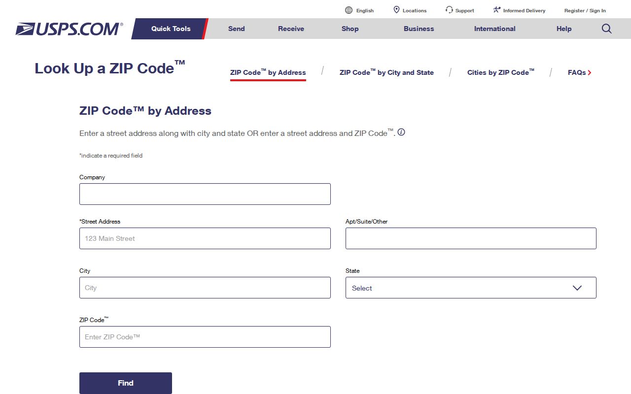
Use the returned code as a postal clue, then compare it with the county parcel record rather than treating it as a city boundary. Library location search also accepts an address or ZIP as a finding aid, but it is not a current resident roll. The San Mateo Public Library California Collection is better suited to historical directory and map work after the address is stabilized.
San Mateo County ZIP Search Fields
The public GIS viewer is useful for resolving a ZIP address to a parcel, but the current research did not document a countywide ZIP filter. These are the real controls to use when an address or APN is known.
| Field or control | Type | Required | Format or use |
|---|---|---|---|
| Search / Address | Autocomplete text | One method | Use number plus street; normalize suffix and directional. |
| APN | Text | One method | County parcel identifier; test punctuation handling live. |
| Map navigation | Pan and zoom | No | Browse a street and nearby parcels. |
| Identify/select parcel | Map click | No | Opens parcel attributes and available links. |
| Layers | Panel and checkboxes | No | Parcels, jurisdiction, boundaries, and available reference layers. |
| Measure, basemap, print | Toolbar controls | No | Context and output tools; exact controls depend on viewer version. |
Use the County Property Information Portal for the map and identify steps. ACRE property-tax lookup is also parcel or address oriented. Neither source should be described as a documented ZIP-wide resident search.
The county publishes daily active-parcel, street, precinct, and city-boundary data in several formats. The GIS data download page supports a reproducible boundary check when the web map alone is not enough.
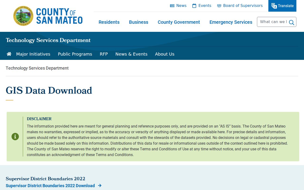
Those downloads can show where a parcel, street, precinct, or city boundary sits, while the ZIP remains a USPS delivery attribute.
Find San Mateo County Residents by ZIP
A ZIP code can narrow the starting area, but San Mateo County does not document a public countywide ZIP filter for the GIS or property portal. The reliable workflow keeps postal verification, parcel identity, and any lawful voter-file use in separate steps.
- Enter the complete street address in USPS ZIP Code by Address. Save the five-digit ZIP and the postal city exactly as returned.
- Search the county GIS viewer by address or APN. Use map click and jurisdiction layers to confirm the parcel, city, or unincorporated area. Do not expect a ZIP-wide list from the public interface.
- Use ACRE property and tax services by parcel or address. If the public result lacks the needed field, use the assessor counter or a focused request to the custodian instead of asking an office to create a new directory.
- For voter information, use California My Voter Status only for a personal identity check. A qualified election, scholarly, journalistic, political, or governmental requester must contact ACRE Elections about the current extract form, purpose certification, fields, delivery, and cost.
- Once the ZIP is narrowed to a verified street and parcel, shift to the San Mateo County street directory for address-keyed work rather than treating the ZIP as the resident key.
Historical research uses a different channel. A library catalog may accept a ZIP or address to find local material, while directories, census schedules, deed references, and newspapers still need their own year and name checks. A postal filter never turns those collections into a current resident list.
ZIP Boundaries and San Mateo County Cities
ZIP boundaries, municipal limits, parcel polygons, and county jurisdiction answer different questions. A ZIP routes mail. GIS identifies the government geography attached to a parcel. The assessor and recorder use parcel, situs, APN, party, or legal-description keys, while Elections applies separate identity and purpose rules. Keeping those layers distinct prevents a postal city from sending a records request to the wrong custodian.
- ZIP code
- A five-digit USPS delivery area. It is a postal field, not a city or county boundary.
- ZIP+4
- Four extra digits that refine delivery within a five-digit ZIP. It does not create a civic jurisdiction.
- PO-box ZIP
- A code used for post-office boxes. It should not be treated as a residential parcel or neighborhood.
- Unique ZIP
- A code assigned to one organization or special postal use. Verify the current assignment before drawing a local conclusion.
- Carrier route
- A delivery-route grouping inside postal geography. It is not a parcel line or a resident roster.
Postal boundary reminder. A ZIP code supports mail delivery. A municipal line, parcel polygon, and county jurisdiction answer different questions, so never swap one for another.
San Mateo County APN Versus Postal Label
APN is the durable key when a street is renamed, renumbered, or carried by a different postal label. Pair it with the situs address, mailing address, map link, and legal description. Situs identifies the taxable site; mailing identifies where tax correspondence goes; legal description identifies the land. None is interchangeable, and a matching mailing and situs address suggests but does not prove occupancy.
When a ZIP conflict still blocks the next step, route the question to the San Mateo County Assessor-County Clerk-Recorder & Elections contact office. ACRE's Recorder Division is at 555 County Center, 1st Floor, Redwood City. Online services, the counter, and a narrowly described public-record request are distinct access channels. Ask for the record held, the date range, and the format available; do not ask an office to infer a countywide resident directory from postal data.
The contact route matters for older or edge-area addresses. Redwood City, San Mateo, Foster City, Hillsborough, the Coastside, and unincorporated communities can share postal clues while using different local services. The APN and GIS jurisdiction keep the search tied to land, even when a ZIP code changes or looks like a city name.
Note: USPS confirms delivery, while San Mateo County GIS and ACRE establish the parcel path that a records custodian can actually answer.
The ZIP code directory is most useful when it narrows a question without pretending to settle it. Verify the postal field, resolve the parcel, respect each office's access rules, and stop at the point where the public record ends.
ACRE contact details and current counter channels are shown on the official county contact page.
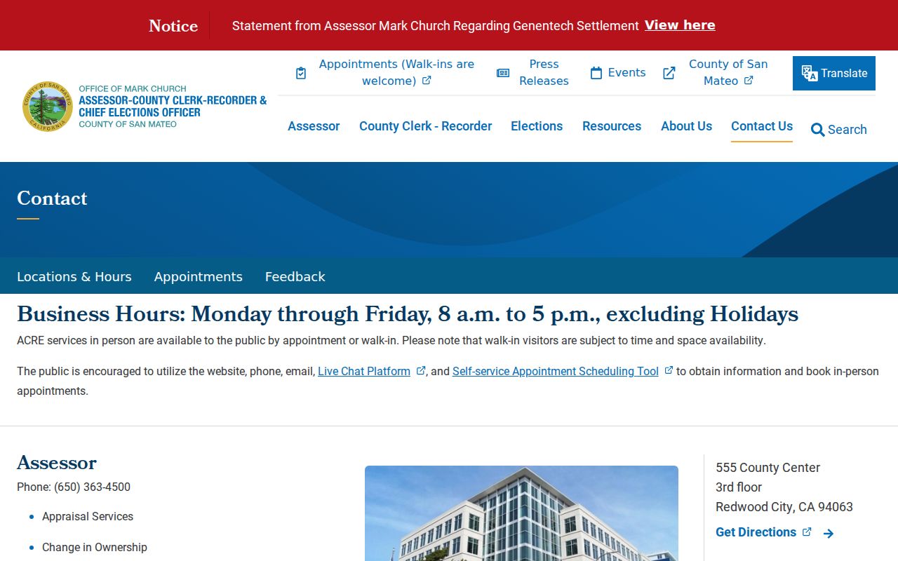
The contact image is a reminder to verify the current office route before relying on a postal or parcel result.