
Search San Mateo County Streets by Address
A useful address trail is a chain of checks. Begin with the number and street as written, then keep the parcel identifier beside every later result. The address search can point to a current site, but the deed index is keyed mainly by people and instruments. The voter system has a separate purpose rule, while an old criss-cross directory may show a listed occupant rather than an owner. This order keeps a street-by-street search from treating one clue as a complete resident list.
- Enter the address in the San Mateo County Property Information Portal or GIS and record the APN, situs address, jurisdiction, and map links.
- Open the parcel details and use the APN and legal description to identify the current acquisition instrument.
- Search the ACRE Recorder grantor-grantee index for the deed parties, then work backward or forward by recording date and instrument number.
- Use California My Voter Status for a personal check, or ask ACRE Elections about a purpose-qualified voter-file request rather than treating the roll as an open street list.
- Finish with San Mateo library directories, reverse sections, census snapshots, and other historical sources when the question is who was listed at the address.
The result is a documented address trail. It is not a promise that every person connected with a home will appear.
San Mateo County Parcel Records
The San Mateo County ACRE Assessor supplies the parcel identity that makes an address search stable. A situs address identifies the taxable site. A mailing address identifies where tax correspondence goes when that field is released. The APN is the county parcel key. Record jurisdiction and map links too, because city and unincorporated responsibilities can split across nearby addresses.
The county reports about 237,000 assessments each year. A recent Property Information Portal upgrade is intended to streamline property information, tax assessment, and parcel-document access. Treat the portal as an ownership and parcel starting point, not as proof that a named owner sleeps at the situs. The tax lookup and assessor counter remain useful when a web result is incomplete.
Assessor questions and copy requests can go to 555 County Center, third floor, assessor@smcacre.gov, or 650-363-4500. That counter and contact route matter when an address search returns an incomplete parcel match.
For a visual starting point, the ACRE Assessor property page shows the public entry route for parcel research.
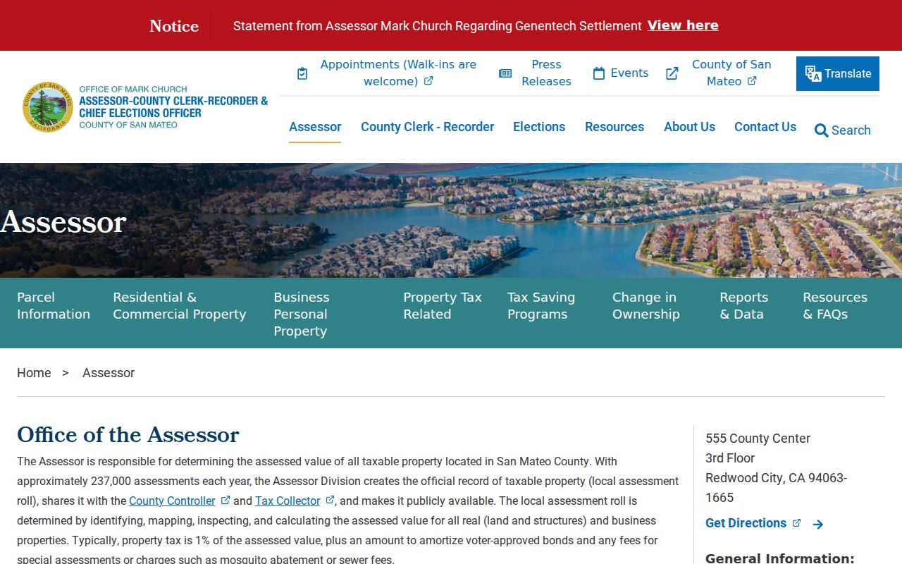
The assessor view helps anchor the address to a parcel before a deed or street-level comparison begins.
| Field or control | Type | Required | Notes |
|---|---|---|---|
| Search / Address | Autocomplete text | One method | Use number plus street; normalize suffix and directional. |
| APN | Text | One method | County parcel identifier; test punctuation handling in the live viewer. |
| Map navigation | Pan and zoom | No | Browse the road and nearby parcel polygons. |
| Identify/select parcel | Map click | No | Opens parcel attributes and available links. |
| Layers | Panel and checkboxes | No | Parcels, jurisdiction, boundaries, and available reference layers. |
| Measure/basemap/print | Toolbar controls | No | Context and output tools; exact controls depend on viewer version. |
San Mateo County GIS Street Parcels
The San Mateo County GIS and Property Records viewer is the street-browse part of the address directory. Search one known number, select its parcel, and then click the polygons beside it and across the road. Pan and zoom until the block is covered. Parcel boundaries are more reliable than the distance between visible buildings, and one structure does not always equal one parcel.
Use the layer panel to keep parcels, jurisdiction, city and county boundaries, and other reference layers visible. County GIS also publishes daily active-parcel, street, jurisdiction, city-boundary, and precinct data in Shapefile, File Geodatabase, AutoCAD, KML, and GeoJSON formats. A download can support a block study, but it does not turn geometry into a resident roster. The public interface does not document a ZIP-wide query or a confirmed buffer tool, so direct adjacent-parcel selection is the dependable method.
The San Mateo County GIS page is the source route for the parcel map used in a by-address parcel review.
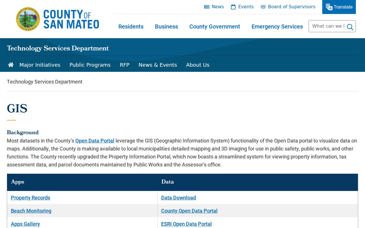
After a parcel is selected, copy its APN and jurisdiction before moving to the recorder, planning, or elections channel.
For a short block, the map gives a clean adjacency method: target address, selected APN, side parcels, opposite parcels, then the responsible local office for each result.
San Mateo County Street Directory Coverage
Address-keyed records answer different questions. The assessor and GIS help define land. The recorder documents parties to instruments. Permits mark work at a site. A directory or census gives a household snapshot. Voter information is restricted and cannot be republished as a general list. Reading the sets side by side makes the San Mateo County address directory more precise than any single search box.
| Record set | Keeper | Street-level value | Access route |
|---|---|---|---|
| Assessment roll | ACRE Assessor | Parcel, situs, values, assessment attributes, and mailing contact where released. | Portal, counter, or narrow records request. |
| Parcel geometry | County GIS and Assessor mapping | APNs, neighboring lots, jurisdiction, and boundary context. | Free viewer and data downloads. |
| Recorded instruments | ACRE Recorder | Grantor, grantee, date, instrument, and legal-description cues. | Online index, counter, or copy request. |
| Permits and plans | City department or County Planning | Site, project, dates, applicants, and contractors where public. | City portal or counter; County PRA fallback. |
| Voter information | ACRE Elections and California Secretary of State | Personal status or a qualified file with residence and district fields. | Personal lookup or certified statutory-purpose request. |
| Reverse directory | San Mateo Main Library | Listed occupants or businesses arranged by street and number. | Onsite California Collection and reference help. |
To reach a former occupant, the parcel number connects the assessor to a deed, while the street and number connect a historical volume to a household. A gap in one set does not prove that the person was absent. It may mean the record was never created, is held by another custodian, is not indexed, or falls outside public display.
Note: A mailing address can point away from the parcel, so it should be logged as a clue rather than treated as proof of residence.
San Mateo County Deed Records
The ACRE Recorder is the bridge from a parcel to named parties. Its grantor-grantee index is a free entry point, but the public landing page does not state the earliest online year. Start with the current acquisition reference from the assessor or parcel material. Search both roles, keep the recording date and document number, and retrieve the instrument or certified copy when the legal description matters.
The recorder field set includes Grantor / Grantee name, Recording Date, Document Number, Document Type, and Book/Page when offered. Spelling variants matter. A seller on one deed can be searched as a grantee in an earlier period. Confirm the APN or legal description at each turn, since a common name may be tied to more than one parcel. A deed proves a recorded transaction, not present occupancy.
When the online result ends, contact the Recorder at 555 County Center, first floor, Redwood City. The office lists recorder@smcacre.gov and 650-363-4500. Ask about earlier books, index help, image access, and copy or certification charges rather than assuming the web index is the full record.
Permits Along San Mateo County Streets
Permit records add a physical timeline to a street search. A permit may show the site address, permit number, application type, status, dates, contractor, scope, or applicant. It can establish when an addition, repair, or other project was proposed. It does not list every prior resident, and a contractor or applicant is not automatically the owner or occupant.
For an incorporated address, begin with the city building or planning department. For unincorporated land, the San Mateo County Planning public-records request channel accepts a request by email, mail, or at the Permit Counter. County Planning can handle a narrow PRA request, while a paid research or review request is the better fit when staff must analyze planning, zoning, or building material. Copies of official plans need owner and design-professional authorization plus an affidavit, and code files may contain privacy redactions.
The image from the County Planning public-records request page points to the fallback when a city portal or parcel search does not expose the needed permit file.
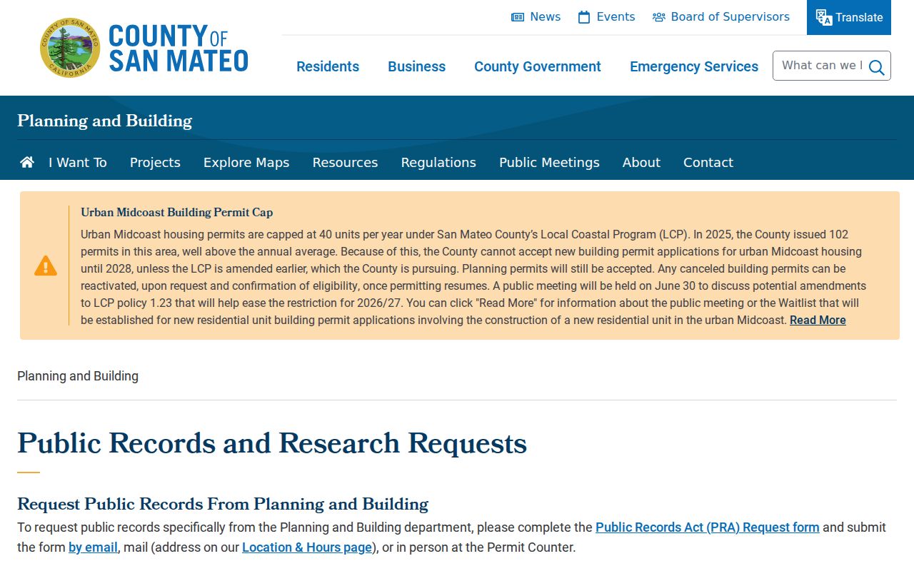
Match the permit address to the APN and jurisdiction first. That small check keeps a city request from being sent to County Planning, or the reverse.
Reverse Directories for San Mateo County Addresses
The historical layer changes the question from who owned the parcel to who was listed at a street number. The San Mateo Public Library California Collection reports city directories from 1907 to the present, including Polk, Haines, and other publishers. The collection supports personal-name, business, and street-address approaches. Later volumes may place a reverse or criss-cross section after the alphabetical pages, but the exact first year for that section is not published.
Call San Mateo Main Library Reference at 650-522-7818 or email smplref@plsinfo.org before visiting. Ask staff to identify the earliest bound volume, missing years, the reverse-section start, publisher runs, reproduction rules, and which Peninsula Library System branch holds a needed city volume. Write down the title page and abbreviation page. An entry can show a surname, given name or initial, spouse, widow notation, occupation, residence address, and sometimes a telephone or homeowner indicator.
A criss-cross hit is a lead to a listed resident or business. Compare it with a deed, census, newspaper, or permit before calling it a full household record. The San Mateo County Directory Book page handles the collection history; the street directory uses those volumes only for the address trail.
Street Terms for San Mateo County Records
These terms recur in an address-based street directory. Keeping them separate avoids a common mistake: reading a parcel label, a tax contact, a title record, and a listed occupant as if they were one fact.
- Parcel
- A defined piece of land tracked by an APN. A parcel can contain more than one structure or address, and an address can change while the APN remains the useful bridge.
- Situs address
- The physical site address used to identify the taxable location. It is not the same as the place where tax mail is sent.
- Mailing address
- The correspondence address attached to a tax or property record when released. It can be off site and does not prove that the owner lives there.
- Legal description
- The formal land description, such as a lot, block, tract, map, or older rancho or metes-and-bounds reference. It is often stronger than street text for old deeds.
- Plat
- A recorded map that lays out lots, blocks, streets, or a subdivision. It can connect an older lot label to a present parcel.
- Criss-cross directory
- A directory arranged by street and house number, often with a listed occupant or business. It is an occupancy clue, not a title record.
Use the APN and legal description when the street wording is old. Use the situs and mailing fields as separate clues, and use a criss-cross entry only for the listed household layer.
San Mateo County Streets Change Names
San Mateo County has no single county street grid. Incorporated cities assign and maintain local addresses, while County Planning and Public Works handle unincorporated sites with public-safety coordination through local agencies. A street can be renamed, renumbered, or associated with a different local service area. The APN, plat, legal description, and parcel jurisdiction give an older street directory a stable reference.
For an old address, search the number and spelling as printed, then test variants and consult the relevant city or County Planning custodian. Compare a historic plat or Sanborn sheet with the parcel geometry. Do not assume that a modern street label is the same as the label in a deed or directory. The county's record history runs from 1856 forward, while pre-1856 land and court facts may sit in San Francisco County, federal patent, or Spanish and Mexican land-grant sources.
Note: The parcel's jurisdiction determines the local permit route; the postal city alone does not.
San Mateo County ZIPs and Street Limits
ZIP codes are delivery geography. They are useful search filters for an address, but they do not decide which local office holds a record. ZIP 94010 spans Burlingame and Hillsborough. ZIP 94404 is strongly associated with Foster City even though San Mateo appears in mailing conventions. Redwood City ZIPs reach into named unincorporated communities. A street directory that uses only a postal city can send a records request to the wrong jurisdiction.
Verify the individual address with the USPS ZIP Code by Address lookup, then use County GIS for the incorporated or unincorporated jurisdiction. County GIS boundaries, not a ZIP label, route a permit or planning request. Do not use a PO-box or unique ZIP as evidence of a residential parcel. For a street-level result, preserve all four labels: USPS city and ZIP, government jurisdiction, APN, and responsible custodian.
San Mateo County Voter Street Rules
California My Voter Status is a personal verification tool, not a public name directory. The form uses first name, last name, and date of birth, with a California driver license or ID number or the last four digits of an SSN when the system requests an additional match. It can return registration status, party preference, voting districts, ballot status, and election information after identity matching.
California Elections Code section 2194 limits voter information to election, scholarly, journalistic, political, or governmental purposes and prohibits commercial use. A qualified file may contain name, residence and mailing address, registration date or status, party preference, precinct and district fields, and ballot participation history. Signatures, full identification and Social Security numbers, and Safe at Home addresses are not released. Street sorting or republication as a general directory is not allowed.
For access questions, contact ACRE Elections at 650-312-5222 or registrar@smcacre.gov. Ask for the current purpose certification, fields, format, delivery route, and fee. Historical great registers are a separate genealogy source held through library, archive, and Schellens research rather than through the personal online form.
San Mateo County Street Directory Limits
A by-address search can miss renters, minors, unlisted household members, people who moved between record dates, and anyone whose address is protected or omitted. DMV personal data is restricted, and utility-customer lists are not public address directories. A deed records a party to a land transaction. A voter record is purpose-limited. A reverse directory records what a publisher chose to list. None should be stretched into a complete list of current neighbors.
Use the San Mateo County street directory for personal, lawful research such as parcel history, family history, civic records, or checking a record tied to a property. Verify important facts with the office that holds the record. Do not publish protected addresses, combine disconnected clues to target a person, or use records to stalk, harass, intimidate, or harm anyone.
Lawful use. Public availability is not permission to follow or threaten a person. San Mateo County address records should support a specific, lawful purpose, with sensitive details left out when they are not needed.